Running the ICW North from Florida: Route and Timing
From Stuart, Norfolk is 988 waterway miles north. When to leave Florida, where the ICW gets thin or rough, and how the run lines up with the season up north.

It's mid-April in Stuart, and the boat has been in her slip since December. Her owner flew home to Michigan two weeks ago. The New York canals open in the middle of May, hurricane season starts June 1, and between the St. Lucie Inlet and Norfolk lie 988 miles of the Intracoastal Waterway. That's the spring run: the ICW north from Florida, timed so she gets to the Chesapeake, the Hudson or New England as the season up there opens.
Most of it is protected water, which is the point of the route. NOAA's Coast Pilot describes the waterway as a canal giving continuous protected passage behind the Atlantic coast. Its mileage starts at zero in Norfolk and counts south, so a boat running north counts down.
When to leave
Work back from where she's going. A boat headed for the Great Lakes wants to reach the Hudson as the New York canals open. The state sets the dates each year, and in 2026 the canals opened May 15. A boat staying on the Chesapeake or in the Carolinas can leave later, but not much later: hurricane season starts June 1, and your policy may care where she is when it does.
Then count the days. A trawler covers roughly 60 to 80 miles a day of daylight running, so Miami to Norfolk is two to three weeks before weather, and the whole run to the Great Lakes takes four to six weeks, weather days included. I'd rather leave Florida in mid-April with days in hand than in May with none to spare before June 1.
Waterway miles to Norfolk (statute miles, from the Coast Pilot)
Miami: 1,089
Port Everglades (Fort Lauderdale): 1,066
Lake Worth Inlet (Palm Beach): 1,018
St. Lucie Inlet (Stuart): 988
Fort Pierce: 966
St. Johns River (Jacksonville): 740
Fernandina Beach: 717
Florida: bridges, slow zones and markers
From Miami up to Jupiter, the federal bridge rules put about 30 drawbridges on their own opening schedules, many only on the hour and half hour, so the first days from Miami or Fort Lauderdale go slower than the chart suggests. North of Stuart, only three more have schedules of their own, St. Augustine's Bridge of Lions among them, but long stretches run through slow-speed and manatee zones. The lowest fixed bridge on the whole waterway is the Julia Tuttle Causeway in Miami, at 56 feet, so a boat that clears it clears every fixed bridge north of it.
Running north, keep the yellow squares on the ICW's markers to starboard and the yellow triangles to port, whatever color the marker is. I go through the zones, the bridges and the markers in boating in Florida vs. the Great Lakes.
Inside or outside
A boat built for it can save days by running outside between the big inlets when the weather is settled. When it isn't, the inside route earns its keep: over the waterway, the Coast Pilot notes, the land cuts wind speeds by as much as 30 percent, the short fetch keeps the waves down, and shelter is usually close by.
Georgia: tides and thin water
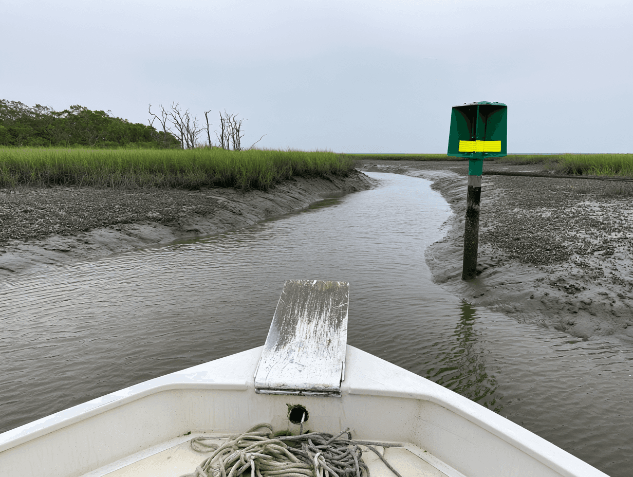
Georgia is nearly 140 miles of the waterway, from the St. Marys River up to the Savannah River, and it asks the most of a navigator. The tide runs big: at Fort Pulaski, at the mouth of the Savannah, NOAA puts the mean range near 7 feet. St. Andrew Sound has the most exposed water on the route south of Port Royal Sound and gets very rough in a strong north, northeast or east wind, so take the protected bypass between Miles 686 and 695.8 when it's blowing. Near Savannah, the ebb out of the Ogeechee River at Hell Gate runs particularly strong, and where the Savannah River ebbs through Fields Cut, strong cross-currents build a shoal at the cut's east end.
The thin water moves. The Corps of Engineers' 2015 dredging plan for the waterway from Port Royal Sound to Cumberland Sound said its dredging had gone to the shallowest spots first since the 1980s, and that heavy shoaling at its mouth made Jekyll Creek the reach needing the most. I'd plan the thin reaches for a rising tide and check the latest weekly Local Notice to Mariners before the Georgia leg. The Coast Pilot says small craft on the waterway need those notices to keep their charts current, since they carry changes to the aids, channel depths and bridge clearances.
The Carolinas: land cuts and open sounds
South Carolina's Lowcountry rivers give way to North Carolina's land cuts, inlets and then its big sounds. Take it slowly for the 18 miles south of Little River, where rock ledges have been reported along the deep part of the channel; the Coast Pilot advises extreme caution there. Where the waterway crosses inlets, plan for current. The Shallotte River causes strong currents and severe shoaling in the waterway, and New River Inlet has dangerous cross-currents except at slack water.
Farther north, stay near midchannel in the Alligator River-Pungo River Canal, where both banks are foul with debris, snags and submerged stumps. Then the main route crosses Albemarle Sound for 12.7 miles. The water level there depends on the wind, the crossing is uncomfortable and even dangerous for open boats in heavy weather, and the swing bridge over the Alligator River is reported not to open in winds over 34 knots. That's a crossing for a calm morning.
Into Norfolk: the Virginia Cut or the Dismal Swamp
The last miles offer a choice. The main route, the Albemarle and Chesapeake Canal that cruisers call the Virginia Cut, has the only lock between Norfolk and Key West, at Great Bridge, with a lift of under 3 feet. The alternate, the Dismal Swamp Canal, is 19 miles of quiet, nontidal canal with a lock at each end, and the locks run four times a day: 8:30, 11:00, 1:30 and 3:30. It's maintained to only 6 feet, and low water can restrict it or close it, so it suits a shallow-draft boat with time to spare.
Past Norfolk
The ICW ends at Norfolk, but most runs north don't. From there it's up the Chesapeake, through the C&D Canal, down Delaware Bay to Cape May and up the New Jersey coast to New York. Great Lakes boats turn up the Hudson for the canals, and New England boats head out Long Island Sound. The canal leg, with its bridge clearances, is in my Great Lakes to Florida guide.
Who runs her
Owners who know their boat can make this run themselves with time in hand and a careful eye on the tide. If you'd rather hand it to an ICW delivery captain, I run boats north on the ICW in the spring, to the Chesapeake or home to the Great Lakes, and each run starts like any boat delivery in Florida. If you'd rather come along and learn the route, that's owner-assisted delivery. Either way, the policy has to cover the whole route, and I don't run a delivery without a rider in place.
Spring runs north fill up over the winter, so February is a good time to settle the dates. If she's coming north in the spring, a quick call sorts out most of it.
Keep Reading

FROM THE HELM
New articles, straight to your inbox.
A short note whenever a new piece goes up — seamanship, ownership, and lessons from the water. No spam, unsubscribe anytime.